This test is run by .
Note that your final mark will not be saved in the system.
Note that your final mark will not be saved in the system.
3.1.3.1 UK physical landscapes Pindrop
Target Level
4-5
Running Total
0
0%
Attempt
1 of 3
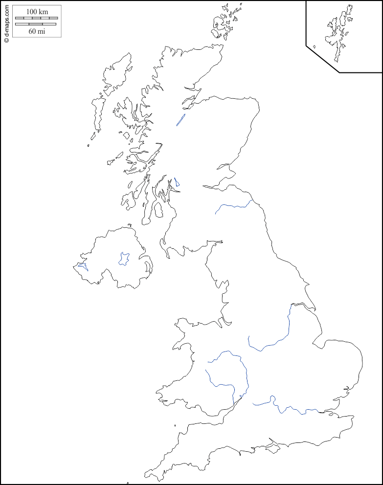
Click on a top label, then click on its correct position on the diagram. Or, drag a top label and drop it onto the correct position. Position all the labels before clicking ‘Check’.
Somerset Levels
River Thames
Dartmoor
Brecon Beacons / Bannau Brycheiniog
The Fens
Southern Uplands
River Trent
The Wash
River Severn
Firth of Forth
Pennines
Grampian Mountains
Snowdonia / Eryri
South Downs
Lough Neagh